A curated set of ArcGIS Pro labs that teach core GIS concepts through real places and real movement—national parks, travel routes, urban access, and sports analytics.
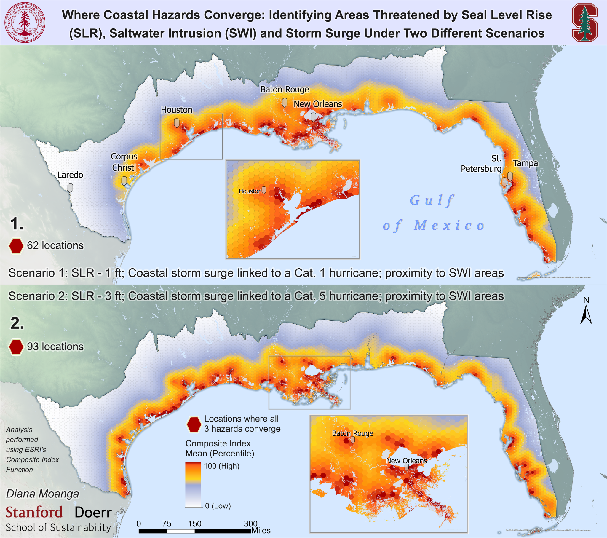
Use spatial data, visualization, and analysis to understand risk, identify patterns, and support decision-making for environmental hazards and community impacts.
ConservationA curated lab theme
GIS for conservation
Apply spatial analysis and mapping to support biodiversity, habitat connectivity, protected areas, and climate‑resilient conservation planning.
Monitoring changeA curated lab theme
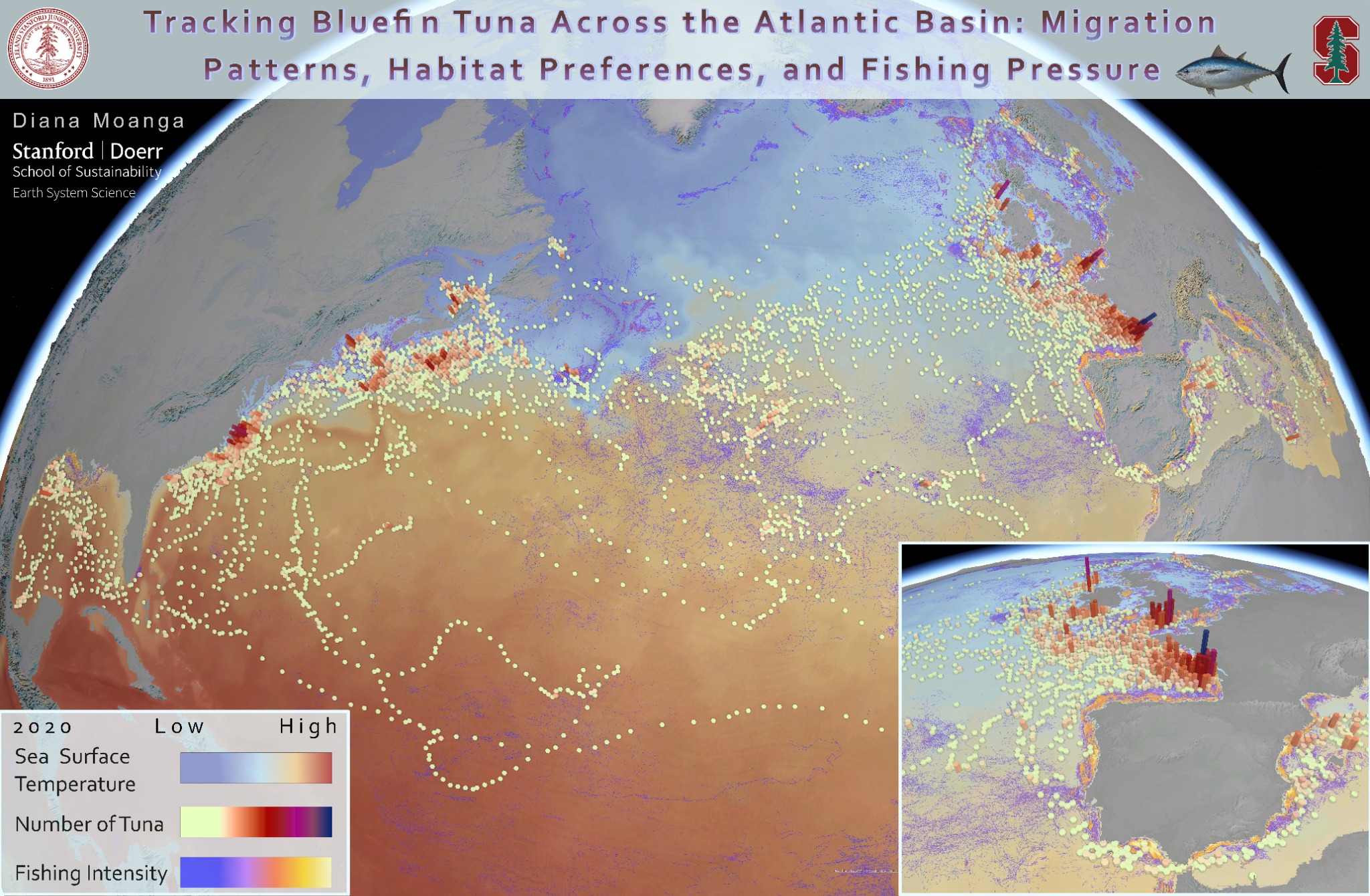
GIS for monitoring change over time
Use time-enabled data, imagery, and spatial analytics to quantify trends and communicate impacts.
Featured work
Featured work in Esri Map Book
Selected cartographic work featured in the Esri Map Book.